On ‘4 August 2020’, a massive explosion took place in the port of Beirut, the capital city of Lebanon. A collage of two photos is being shared on social media claiming it as before and after images of the destruction caused by the explosion in Beirut city. Let’s verify the claim made in the post.
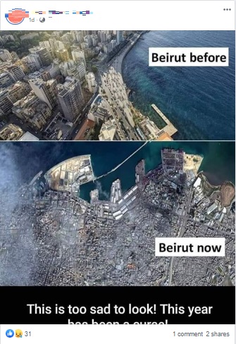
Claim: Image of Beirut city after the destruction caused by the recent explosion.
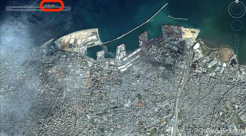
Fact: Image that was shared as the condition of Beirut city after the Explosion was found on Google Earth since 2011. Hence the claim made in the post is FALSE.
On reverse image search, it is found that both photos in the post are related to the Beirut city of Lebanon. But, the photo that was shared as the condition of Beirut city after the explosion was found in a thread posted in a forum in 2013. When we searched for the same image on Google Earth Pro installed on a desktop, we found the exact same image of the Beirut city on it in 2011.
When searched for the satellite pictures of Beirut city after the explosion , we found the satellite pictures of Beirut city before and after the blast in an article published by the ‘Space.com’ news website. In the website, it is mentioned that a SkySat spacecraft, operated by SanFrancisco based company ‘Planet’, captured this detailed images of both before and after the blast in the port of Beirut. These satellite pictures can be found in a tweet made by the official twitter account of ‘Planet’ company. ‘The Guardian’ and ‘BBC’ news websites have also published articles comparing the before and after pictures of the blast in Beirut city. They can be seen here and here.
To sum it up, satellite image of Beirut city before the explosion is falsely shared as that captured after the explosion.
Did you watch our new video?


1 Comment
Pingback: Dilapidated Satellite image falsely shared as that of the Beirut metropolis after fresh explosion | Rajasthan Coverage